Offshore sailor Henry Bomby reviews Squid, a new weather software program that collates information online and provides routeing as well as forecasting
Squid weather software program
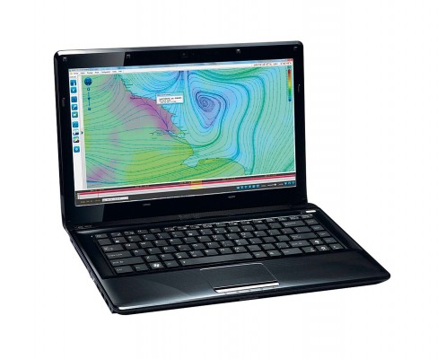
This is an exciting new weather program that collates online weather information. Developed by experienced offshore sailors and navigators, Squid weather software has been designed as a tool to download and compare different weather models to help crew make their own interpretations.
Accessing surface pressure charts and GRIB files (GRIdded Binary – the format used to transport and visualise weather data) for different weather models has not always been easy. Squid’s primary objective is to give sailors access to all the weather information available to create an accurate, yet cost-effective, passage-planning tool.
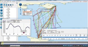
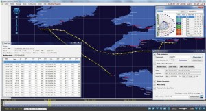
You can download a number of GRIB files from different geographic weather models, as well as pressure charts, satellite images and wind observations to create an optimum or safest route for your passage. Perhaps the most useful features are the ability to run routeings and the Best Start function. This suggests the optimum time to leave in order to complete a passage in the shortest time, or the best route to avoid inclement weather.
For those downloading forecasts at sea, satellite phone bills can be eye-watering. Squid weather softwarehelps keep costs down; you choose exactly the information you require, breaking the GRIB files down into pieces. For example, you can choose to download solely wind information to reduce download data, or add in more details such as pressure, rain, gust, cloud cover and humidity, etc.
Squid also allows you to request GRIB files via email while at sea to input into your routeing software. Uniquely, you can also send off for routeings, eliminating the need to buy expensive software.
The program has been awarded a partnership with the Volvo Ocean Race. It gathers and distributes all relevant weather information to its own bespoke version for the race.
Squid’s top features
GRIBs
A large variety of GRIBs can be downloaded using Squid, including the weather models GFS, CEP, NAM and its own model called GCWF. GCWF+ gives very high-resolution GRIBs of key race areas around the world, including the Isle of Wight. The ability to break the GRIBs down by choosing whether you take additional information is a prime benefit when at sea and looking to reduce file download size.
Surface pressure charts
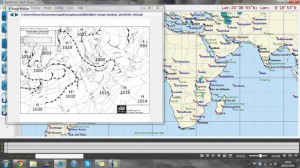
Squid allows you to download all the surface pressure charts globally. Bracknell, DWD and NOAA are the most relevant to UK/Atlantic sailors, but you can also download surface pressure charts for the South Atlantic, Caribbean, Pacific, Indian Ocean and the Southern Ocean. The download size can be selected each time and the files are saved on your computer for offline working, which is very useful.
Satellite images
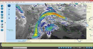
Squid lets you choose between ‘visual’ and ‘infrared’ images, plus the number of time ‘steps’ (one step every 15 minutes) you wish to take. This is especially handy before leaving the dock to see whether a front is currently arriving on time or ahead of schedule. It could also be helpful to those sailing in the tropics where sailors are looking to avoid either big squalls or developing clouds that could spell wind holes.
Best Start
Originally designed for racers to determine the best start time for record attempts, this feature is equally useful to analyse the best time to set off on a crossing or a delivery. Simply enter your preferred time and duration for a particular passage and Best Start will calculate the shortest time period in which to do the passage – with weather avoidance settings available.
Routeing
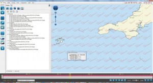
With Squid you don’t need to buy an additional routeing program. In a similar way that you can send off for a specific GRIB, you can also request a routeing via email. Squid has a growing database of boat polars to choose from for those without unique polars.
Verdict
The future of how we download weather files both on land and sea. Great product used by the best in the business.


