
Australia's Gulf of Carpentaria is the gateway to the Indian Ocean for many world voyagers. Catherine Lawson sails where the outback meets the sea
“That sea sure is mean,” our kind driver observes as my salty trio climbs into his truck, fresh off a rough-and-tumble crossing of the Gulf of Carpentaria. After 48 hours of swift sailing – double-reefed and surfing at 14 knots ahead of a 25-30 knot breeze – we wholeheartedly agree.
The downwind surfs might have had us smiling, but the gulf’s walloping, side-swiping, tidal swell comes at you from another angle entirely, giving rise to its reputation as the so-called ‘washing machine’.
Having arrived in Australia’s Northern Territory we hitch into Nhulunbuy from Gove Harbour for fresh supplies, staring out the window at the parched Arnhem Land scrub. Our new mate – an indigenous Yolngu elder – yarns about sailing and one gnarly trip when his Indonesian wife threw up all the way to Sulawesi.
“But that was nothing compared to the Gulf of Carpentaria,” he says, and we all laugh and nod.
The Gulf of Carpentaria occupies a tremendous expanse (some 120,000 square miles) between Australia’s most northern tip, and what’s locally called the ‘Top End’. Cyclones brew up in the gulf at the start of every year, then spiral outwards in all directions. When they abate and the south-easterly trade winds begin to blow, crossing the gulf is all part of the journey for westbound sailors making passage from the Pacific via Australia’s East Coast to Indonesia and beyond.

‘Each of these anchorages has something special to offer’. Photo: David Bristow
Setting out from Cairns in the protection of the 2,300km-long Great Barrier Reef, cruisers can dally on a remote coastline, blissfully castaway on tropical isles and barely-there sand cays.
Once at the tip of Cape York, a transit lane squeezes boats through the Torres Strait islands that pepper the gap between Papua New Guinea and Cape York. To the west lies the Gulf of Carpentaria and one wildly pitching passage to reach Arnhem Land and cross the Arafura Sea to Darwin.
This largely uninhabited slice of Australia can be an utterly idyllic cruising ground but the challenges stack up too: massive tides, boat-stopping currents, and estuarine crocodiles that make cooling off at day’s end a potentially fatal idea.
There’s a scarcity of supply points and limited help when things go wrong, but for remote-loving explorers it’s the stuff of dreams, and sailors get to know it best.
From Cairns, distant Darwin lies around 1,400 sailing miles away. The journey might take weeks or months, depending on how long you spend diving Lizard Island’s fringing reefs, or whether the barramundi are biting in the faraway Wessel Islands.
It’s a trip to be savoured if schedules allow, and one that routinely turns cruisers into more self-reliant versions of themselves.
Article continues below…

Cruising Australia’s east coast: ‘A delicious mix of modern convenience and truly isolated’ adventure
When we tell people we’re bluewater cruising around the world, the first question is almost always the same: ‘What about…

Cruising Australia: Everything you need to know about sailing Down Under
“It doesn’t matter where you choose, you can’t go wrong in Australia. There are so many wonderful cruising grounds,” says…
Escaping Cairns
We sail out of Cairns on the back of the season’s last cyclone, loaded low with fuel and food to ride the trade winds north. Come April, these are winds you can depend upon, blowing steadily up Cape York at 15-25 knots on average and sending yachts into hiding at day’s end behind many solid, north-facing anchorages.
In our first weeks we make abysmal progress, waylaid at progressively more deserted isles. From Low Islets to Hope Islands and Lizard Island north of Cooktown, we drag our heels snorkelling luminous, blooming reefs abuzz with blue spotted lagoon rays, green sea turtles and skittish schools of enormous humphead wrasse.
We drop anchor in Watson’s Bay in 3m of the clearest water on the East Coast, scattering jauntily coloured parrotfish. When a small saltwater crocodile settles into our anchorage, Lizard Island’s park rangers declare it only a minor nuisance, so we scuba dive the Clam Gardens and sit on the seabed watching reef sharks circling overhead.

The route across the top
Girthed by 24 shimmering, white-sand beaches, Lizard Island remains spectacular despite being routinely blasted by some of the worst tropical cyclones on the coast. It incongruously hosts a five-star resort, a world-class marine research centre, and national park campsites that you can pay for with pocket change.
We swim ashore and climb lofty Cook’s Look. It was this peak that a troubled Lieutenant James Cook climbed back in 1770 as he searched for a way out through the maze-like Great Barrier Reef. He in turn named Lizard Island for its ubiquitous population of yellow-spotted monitors, and left a happy man.
After visiting the little-known Indigenous Australian ceremonial site tucked beneath the 359m-high summit we hike past colonies of restless black flying foxes to faraway Coconut Beach, and tackle a daring abseil on a dodgy rope to reach a shoreline littered with perfect nautilus shells.
There are also dinghy adventures to snorkel the Blue Lagoon, and picnics at Mermaid Cove, all of which means we depart weeks later.

Cape York has a long history of guiding seafarers north. Photo: David Bristow
Cape York cyclones
Early in the dry season, Cape York cruisers keep an eye on their barometers for any tropical lows arriving unfashionably late in season. When they threaten on the Cape there are few places to run, but Princess Charlotte Bay grants us refuge when Cyclone Ann crosses the coast. We plunge deep up the Normanby River and strip the decks in readiness.
When we resurface days later – after feeling barely a breeze – we sail to Flinders Island (Wurriima) to grill our catch of queenfish and watch dugongs grooming the highest diversity of sea grasses on the entire eastern coastline. We discover shell middens and an ancient spring, and fish for delicious flowery rock cod as crocs cruise by.

The daily catch is baked at dusk to avoid crocodile encounters. Photo: David Bristow
Flinders’ remote group of sandstone isles belongs to the Aba Yalgayi saltwater people who fished, painted and were buried here. The Yindayin rock art shelters on Stanley Island are the best on Cape York, and the hidden trail to Tombiembui Rock provides a surreal sea view. Unmarked graves hold the remains of a cavalcade of hermits and entrepreneurs, and you can wander past old wells to the rock famously autographed ‘HMS Dart 1899’ by the survey ship’s crew.
Rounding the tip
With fair winds, the leap from Flinders Island to the tip of Cape York can be tackled in four easy day hops: to Morris Island (60 miles), Portland Roads (60 miles) and Margaret Bay (45 miles). All provide refuge before the final 90-mile jump to Australia’s most northerly point and around into shallow, spectacular Frangipani Bay.
Each of these anchorages has something special to offer but Margaret Bay is a favourite among anglers, also holding a dubious reputation as a beachcombers’ nirvana. We follow the wild tangle of a trail that sailors have marked with sea junk to reach Margaret Bay’s south-facing beach across Indian Head. Among the startling array of heaped up plastic flotsam, fossickers routinely find fishing lures and snorkelling gear, buoys, buckets, jerry cans and wetsuits.

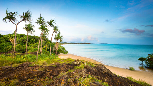
A gentle beginning in the Gulf of Carpentaria – a rite of passage for westbound sailors. Photo: David Bristow
We use our machete to crack open a round of fizzy green coconuts, and spot a packet of Assorted Cream biscuits that somehow floated ashore intact. Because we are hungry and have a curious child in our midst, we dare each other to sample two before declaring them inedible and leaving them for the wild pigs.
The trip from Margaret Bay to ‘The Tip’ of Cape York can be broken up with a nudge into the Escape River, or a terrible night’s sleep at swell-plagued Bushy Isles. During the southeast trades, fast runs come with a big following sea and, with an early start, we aimed to be tucked around Cape York in time for sunset.
We’d been on the helm since the early hours, racing ahead of gale-force winds gathering to the south. Out of nowhere a dory appears, tossed clean out of the water with its propeller spinning atop a huge cresting wave. It veers towards us for a crazy, mid-sea conversation, sidling expertly alongside our catamaran Wild One in the heaving swell.
Over the roar of the waves we confirm two things: yes, we are indeed all “mad bastards” and yes, we would most definitely like some of his catch of (usually $100-a-pop) painted crayfish. These are thrown over our rails as we surf recklessly at 13 knots, Dave gripping the helm while I race around the deck, scooping up the crayfish before the sea claims them back again.

Catch of the day – painted crayfish. Photo: David Bristow
Moments later the dory peels away, back to its mother ship rolling at anchor behind the slenderest of sand cays. We coast with the rapid flooding tide through Albany Passage at dusk, rounding Cape York to toast a ‘Top of Australia’ sunset with buttery, pan-fried crays and the last of our cold beers.
Aussies consider it a must to walk the short, rocky trail over Mount Bremer’s low-lying spine of rock, and stand at The Tip watching Torresian imperial pigeons in flight. At high tide, you can dinghy ashore in shallow Frangipani Bay to snap the sign that says you’ve officially made it. Frangipani Bay is a magical spot to anchor for the night, with the first supply point since Cooktown just around the corner.
A breezy beachfront spot settled by Saibai islanders in 1948, Seisia rewards sailors with picturesque sunsets over Red Island and the chance to fill fuel tanks and fridges. The local service station brings a truck down to collect our jerry cans, and we beach our dinghy and wander to the supermarket to gather fruit, veggies, eggs and more.
We are fortunate to be in Seisia when a bee sting turns serious and, within minutes of making the call, our daughter is whisked to the closest hospital in nearby Bamaga for treatment. What follows is an unnerving cavalcade of ‘what ifs’ had our boat been anywhere en route and out of reach of medical help. But our daughter soon recovers and we wait impatiently in Seisia for less wind, then plunge through the treacherous Carpentaria Straits anyway, getting whipped for our restlessness by heaving waves and 30-knot winds.

Green sea turtles graze the seagrass of the Great Barrier Reef. Photo: David Bristow
Battling the Gulf
The sail across the Gulf of Carpentaria is rarely a gentle ride. Having sailed it six times in both directions, on different boats and at different latitudes, I’ve found none of these trips to be entirely pleasant. The direct route from Seisia to Gove Harbour clocks up 350 miles – a short passage, but with south-easterlies snapping at your heels, there’s no rest to be had.
Midway across, a steep, beam-on swell commonly develops to compete with a windy, following sea. Even if your autohelm can handle it, your stomach may not. We snatch sleep – fully clothed – in between tiresome stints on the helm. Brown boobies struggle to land (never a good sign), and leave us at sunrise with a messy, fish-strewn deck. When someone shouts ‘land ahoy’ as Cape Arnhem comes in view, the sea state tempers so suddenly we wonder if the conditions had really been all that bad?
Reaching protected Gove Harbour is a mid-trip milestone. Some sailors shoot straight past, pointing high over the top of the Wessel Islands. But immersing yourself in one of northern Australia’s friendliest and remote towns is a grand perk here, and while hitchhiking the 13km from harbour to Nhulunbuy, we meet mine workers and radio DJs, bank tellers and our Indigenous elder mate, who gives cultural orientation classes at the town’s university.

Boats push north out of Cairns when the south-easterlies begin to blow. Photo: David Bristow
Inspired, we hire a car and drive to Wurrwurrwuy, a sacred Indigenous Australian site where Laramirri (Yolngu) people and seasonal Indonesian Macassan fishermen established a mutually beneficial camp 170 years ago. The Yolngu created stone arrangements that are still intact today – dugout canoes and beche-de-mer fishing boats – and traded hunting rights for the canoes and stone tools that arrived with the Sulawesi fleet every December. When the boats returned to Indonesia with the same change of winds that carries sailors today, intrepid Yolngu men often shared the 1600km journey and inextricably linked family trees on both sides of the Arafura Sea.
The furious Arafura
Nicknamed the Ara-furious for its fierce-flowing tidal currents, the Arafura Sea is studded with uninhabited islands, precarious reefs and great sweeps of deserted sandy beach. Fishing in protected anchorages, you’ll likely have to pull your lines in after an hour or two after filling your fridge and freezer with Spanish mackerel, queenfish and tuna.
The isolation of cruising here can surprise even the boldest of passagemakers, and unless you arrive with them, other cruising boats are in short supply. There’s little chatter over VHF radio and no phone signal unless you sail close by the coast’s scattered Indigenous towns, making Starlink a legitimate lifeline.

Once around Bremmer Island the Gulf of Carpentaria sea state tempers abruptly. Photo: David Bristow
Swift tidal currents running between islands determine when you weigh anchor, and these can run at up to nine knots through the famous squeeze known as ‘Hole-in-the-Wall’ or Gugari Rip. Travelling against these tides is an exceptionally bad idea, but when you time things right, expect to score dreamy personal best sailing speeds!
A popular route across the Arafura pushes west out of Gove Harbour around Cape Wilberforce to Wigram Island, and through Cumberland Straits to the protected west side of the Wessel’s Marchinbar Island. Point straight across the Arafura Sea to New Year Island, or day-hop down the island chain to gorgeous Guruliya Bay and Elcho Island before making the overnight leap to deserted North Goulburn Island.
Here we wandered with great herds of goats and hiked along sweeping Malay Bay, before flying through Bowen Strait past Croker Island to tuck out of the swell inside Port Essington on the Cobourg Peninsula.
Wild, remote and best explored by boat, Garig Gunak Barlu National Park offers some of the finest hunting and gathering on the coast. We go mud crabbing with head ranger Robbie Risk along Caiman Creek. The tide is all-wrong so we gather ‘long bums’ instead, pulled from clear tidal pools and roasted over hot coals. Risk, a local Larrakia man who grew up on such delicacies, declares them excellent bush tucker, but they taste like mangrove mud and are truly a tough sell. Instead we head back to our boat to dine on fresh oysters and tally up all the enormous crocodiles lying on the beach.

Estuarine crocodiles make a cooling swim at the end of the day a really bad idea. Photo: David Bristow
Before sailing off, we motor deep into Port Essington to explore the Victoria Ruins, known as Murrumurrdmulya to the Madjunbalmi people. Northern Australia’s first and boldest white settlement lasted just 11 years before isolation, malaria, cyclones and sunken supply ships buried a quarter of its pioneers. Anchor directly off Adams Head and leave your dinghy beneath the old tamarind tree to wander trails through this idyllic spot, spooking the wild Indonesian cows known as ‘banteng’ as you go. Although endangered in Indonesia, Cobourg’s feral banteng represent the world’s largest wild herd, a legacy of Macassan fishermen.

Getting the tides right is the toughest part of working your way to Darwin. Photo: David Bristow
Dundas Strait to Darwin
The toughest challenge of completing the last leg is getting the tides absolutely right. Work with them and it’s a brisk run into Darwin; get it wrong and you’ll be treated to one of the worst sea states of your sailing career.
An enormous amount of water and wind gets funnelled through the 15 mile-long opening to Dundas Strait, making for choppy conditions and strong tidal streams.
Overfalls appear where shoals rise from the seabed, and the equalisation of different tidal ranges – 2m tides in the Arafura Sea and 7m tides in the Beagle Gulf – churn Van Diemen Gulf into a steep breaking sea.
For a good, swift run, aim to be around Cape Don just as the tide turns westerly – about four hours before high water in Darwin. With enough speed (at least six knots of boat speed plus the extra two you’ll gain from the tide), you can be through Dundas Straits and the Van Diemen Gulf in time to catch the flood tide and a swift ride past the Vernon Islands into Darwin. Prepare for 25-30 knot winds when the south-easterlies blow in the dry season, and plot a course that avoids any shallow patches, no matter how tempting the shortcut might seem.

The largely uninhabited Gulf of Carpentaria can be an idyllic cruising ground. Photo: David Bristow
If the day doesn’t go to plan, Cape Hotham offers safe harbour (albeit on a reefy shore), located halfway just before you close on Clarence Strait. The Clarence Strait spits us out of its pitching, quickening current and the wind finally tempers. Ahead of us, Darwin’s bright city lights blaze and adrenalin ebbs away to be replaced by a new sense of trepidation.
After so long in isolation, Darwin’s best dry season anchorage at Fannie Bay seems dauntingly busy. We briefly crave a slice of city life, but it proves no match for the thrill of the next adventure, and soon all thoughts turn to our passage to Indonesia.
 If you enjoyed this….
Yachting World is the world’s leading magazine for bluewater cruisers and offshore sailors. Every month we have inspirational adventures and practical features to help you realise your sailing dreams.Build your knowledge with a subscription delivered to your door. See our latest offers and save at least 30% off the cover price.