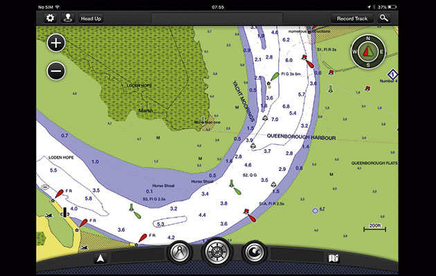
Slick and well designed navigational planning app that integrates seamlessly with onboard Garmin systems
Garmin BlueChart Mobile app for iPad
BlueChart Mobile uses a slick and fast vector chart with good customisation settings including the ability to change the information displayed on a sliding scale of five levels. Drop the slider to declutter the screen when zoomed out for planning longer routes – however do remember to adjust settings back to maximum information for navigation.
Tapping on the screen opens a fast, easy-to-use circular menu for creating waypoints and routes, but the app does not have the ability to follow a route and is designed for planning purposes only.
The basic weather option will download a free seven-day, low-resolution, GRIB file that can be viewed as an animation. Tidal currents are not animated and are represented as two graphs, one for direction and one for speed.
Garmin supports Active Captain as a layer that can be switched off, which keeps the chart uncluttered until you actually want the information.
Coupled with a wi-fi router, BlueChart Mobile will link with other Garmin devices enabling the exchange of route and waypoint information between them. Used in this way, the app lends itself to remote planning and then full integration to an onboard Garmin system.
This is a high quality app and great for use as a planning tool or a straight-up chartplotter, although it lacks the ability to follow waypoints. If you already have Garmin instruments on board then this app will fully integrate across platforms.
Verdict
BlueChart is very much a planning tool and would be particularly useful for planning at home if you already have a Garmin plotter onboard; it could be used for situational awareness while cruising but I do not think this is the best choice for racers.


