Edit: Feb 2017 - This test is superseded by iSailor review by Pip Hare.
We tested the iSailor iPad app as part of a group review of portable chartplotting software. • Transas • Vector charts • App Free. Charts vary in scope and price – eg £11.99 UK chart area, £17.49 Baltic Southern Part, £17.49 Spanish Med
iSailor iPad app
Edit: Feb 2017 – This test is superseded by iSailor review by Pip Hare.
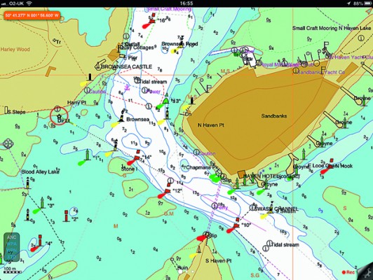
iSailor iPad app has clear, easily viewed charts with optional boxes to display lat and long, course, distance, XTE and ETA, without having to change the whole display. It has other neat tricks, such as being able to export/import route data, an anchor alarm, making passage planning ashore easy, and for £6.99 you can unlock extra features such as AIS transponder input via TCP.
The charts are expensive if you need a large area: £11.99 per folio in the UK, with 18 folios covering the whole country, variable pricing elsewhere. But if your sailing is concentrated in one area – for example charts for the West Country or Ireland South Coast – both £11.99 or French Med £17.49, the pricing of these charts might be better value than having to pay for access to charts for the whole country or region.
They are, incidentally, simple and quick to download on a mobile signal and seamlessly paid for through Apple iTunes.
See reviews of the other iPad apps in our group test
Verdict
Clarity of charts, navigation and route functions are the real pluses for this app, which has been well thought out to display what the navigator needs on one simple page


