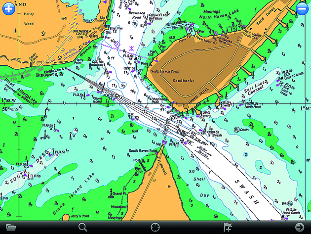
We tested the Memory Map iPad app as part of a group review of portable chartplotting software. • Raster scanned charts • App £Free • Charts for all UK and Ireland £25
Memory Map iPad app
Memory Map’s UK and Ireland charts are scanned Admiralty Hydrographic charts with all their advantages, particularly for anchoring or rockhopping. Simply nothing else beats the fine detail of these charts. That said, the same criticism applies to the Memory Map iPad app as to the Imray iPad app. The app lacks functionality and the user experience is disappointing compared with more developed vector apps. Coverage is impressive, with 800 UK and Ireland charts and harbour plans, but the most annoying aspect of these is that they don’t zoom seamlessly between downloaded charts – you need go to a menu to choose another folio, although the ship’s position cursor will move between charted areas and scales.
On the face of it, price looks to be a plus point: £25 for mobile marine charts for the UK and Ireland, for example, and £50 for PC and mobile. But the charting is reissued annually and unlike other apps, notably Navionics, what you buy doesn’t cover updates, so to keep current you’d have to fork out again.
These charts also lack other features that make apps like, for example, Navionics such a good buy. There’s no live tidal data or weather information either.
See reviews of the other iPad apps in our group test
Verdict
Good if you want a simple position on this paper-type chart format, but usage feels stodgy. Price is attractive, though, especially compared with paper folios.


