
Despite being one of the major players in vector cartography, using the well-established CMaps, the Plan2Nav iPad app is old-fashioned, clunky and slow. We found it short on functions and…

Despite being one of the major players in vector cartography, using the well-established CMaps, the Plan2Nav iPad app is old-fashioned, clunky and slow. We found it short on functions and…
Edit: Feb 2017 – This test is superseded by Garmin BlueChart test by Pip Hare. The Garmin iPad app has big clear buttons and is easy to use –…
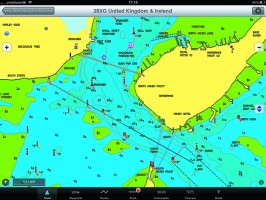
Edit: Feb 2017 – This test is superseded by iNavX review by Pip Hare. The ability of the iNavx iPad app to read both raster scanned and vector charts makes…
Edit: Feb 2017 – This test is superseded by iSailor review by Pip Hare. iSailor iPad app has clear, easily viewed charts with optional boxes to display lat and long,…

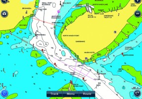
Memory Map’s UK and Ireland charts are scanned Admiralty Hydrographic charts with all their advantages, particularly for anchoring or rockhopping. Simply nothing else beats the fine detail of these…
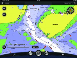
Navionics is the market leader in iPad and iPhone navigation apps. They were one of the first to launch mobile products and the apps are regularly developed and updated.

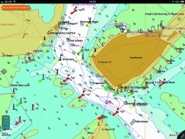
Instantly recognisable, Imray’s popular e-charts show exactly the same detail as the paper versions they have been scanned from. While this may inspire confidence in the Imray iPad app…